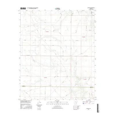
2017 Map of Mist NW
USGS Topo · Published 2017About this map
Bearhouse Cr and Holley Cr wind through the timberlands and wetlands of the Arkansas Gulf Coastal Plain, marking the landscape of this 2017 survey. Situated along the boundary of Drew and Ashley counties, the area is characterized by a dense network of forest management roads and historical transport routes, including Gates Mainline Rd and Old Tram Rd. These labels suggest a legacy of timber harvesting and local transit that shaped the development of these rural townships.
Find a feature on this map
51 named features on this map. Tap any name to fly to it.
Don’t see what you’re looking for? This feature index may not catch every label — zoom into the map to look around manually.
Map Details
Editions of this 2017 Mist NW Map
This is the sole edition of this map. No revisions or reprints were ever made.
Other maps of this area

1935 · Mist
USGS Topo · 1:62,500

1935 · Cominto
USGS Topo · 1:62,500

1952 · Fountain Hill
USGS Topo · 1:24,000

1953 · Greenwood
USGS Topo · 1:250,000

1956 · Greenwood
USGS Topo · 1:250,000

1960 · Snyder
USGS Topo · 1:24,000

1960 · Mist
USGS Topo · 1:62,500

1960 · Collins
USGS Topo · 1:24,000

1960 · Collins
USGS Topo · 1:62,500
1960 · Line
USGS Topo · 1:24,000