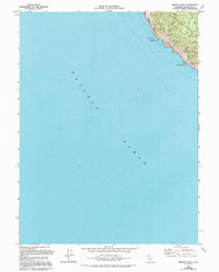
1969 Map of Mistake Point
USGS Topo · Published 1994About this map
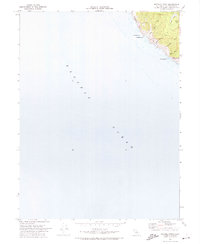
Sinkyone Wilderness State Park dominates this coastal landscape, where the steep terrain of the Mendocino shore meets the Pacific Ocean. The map reveals a remote network of trails and primitive camps, such as Little Jackass Camp and Anderson Gulch Camp, which serve as small outposts in the dense woods. Steep drainages like Northport Gulch and Dark Gulch carve through the coastal range, leading to distinctive landforms like Mistake Point and the towering Anderson Cliff.
Find a feature on this map
22 named features on this map. Tap any name to fly to it.
Don’t see what you’re looking for? This feature index may not catch every label — zoom into the map to look around manually.
Map Details
Editions of this 1969 Mistake Point Map
3 editions found
Other maps of this area

1921 · Westport
USGS Topo · 1:62,500

1950 · Piercy
USGS Topo · 1:62,500

1950 · Cape Vizcaino
USGS Topo · 1:62,500

1951 · Cape Vizcaino
USGS Topo · 1:62,500

1957 · Ukiah
USGS Topo · 1:250,000

1960 · Ukiah
USGS Topo · 1:250,000
1966 · Westport
USGS Topo · 1:24,000
1969 · Piercy
USGS Topo · 1:24,000
1969 · Mistake Point
USGS Topo · 1:24,000
1969 · Bear Harbor
USGS Topo · 1:24,000