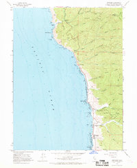
1966 Map of Westport
USGS Topo · Published 1968About this map
Westport and the surrounding Mendocino coast appear here during the mid-1960s, a landscape defined by steep ridges and the complex drainages of Cottaneva Creek and Wages Creek. Small coastal settlements like Rockport, Hardy, and DeHaven are tucked between the shore and the timbered slopes of Alviso Ridge and Packard Ridge. The mapping reveals a coastline of significant relief, where Cape Vizcaino and Cottaneva Needle stand as prominent landmarks against the Pacific Ocean. Along the shore, the Westport-Union Landing State Beach highlights the area's transition towards recreation, while inland features like the Rockport Fire Sta and numerous mountain passes suggest the ongoing management of the rugged coastal range. Local history is preserved in small details, such as the lonely Grave located near Little Howard Creek.
Find a feature on this map
48 named features on this map. Tap any name to fly to it.
Don’t see what you’re looking for? This feature index may not catch every label — zoom into the map to look around manually.
Map Details
Editions of this 1966 Westport Map
3 editions found
Other maps of this area

1920 · Cummings
USGS Topo · 1:62,500

1921 · Westport
USGS Topo · 1:62,500

1921 · Branscomb
USGS Topo · 1:62,500

1950 · Piercy
USGS Topo · 1:62,500

1950 · Cape Vizcaino
USGS Topo · 1:62,500

1951 · Cape Vizcaino
USGS Topo · 1:62,500

1951 · Branscomb
USGS Topo · 1:62,500

1952 · Leggett
USGS Topo · 1:62,500

1957 · Ukiah
USGS Topo · 1:250,000

1960 · Ukiah
USGS Topo · 1:250,000