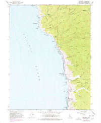
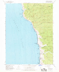
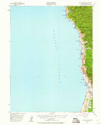
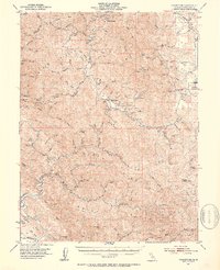
1966 Map of Westport
USGS Topo · Published 1978About this map
Rockport and Westport anchor this coastal survey, where the rugged topography of the Mendocino shoreline meets the Pacific Ocean. This landscape is defined by steep ridges and narrow gulches, with Cottaneva Ridge and Hardy Ridge directing numerous waterways like Cottaneva Creek and Hardy Creek toward the sea. The settlement pattern follows the narrow terrace above the cliffs, connected by what would become the coastal highway, passing through smaller locales like Hardy and Union Landing.
Find a feature on this map
56 named features on this map. Tap any name to fly to it.
Don’t see what you’re looking for? This feature index may not catch every label — zoom into the map to look around manually.
Map Details
Editions of this 1966 Westport Map
3 editions found

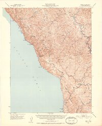
Other maps of this area

1920 · Cummings
USGS Topo · 1:62,500

1921 · Westport
USGS Topo · 1:62,500

1921 · Branscomb
USGS Topo · 1:62,500
1950 · Piercy
USGS Topo · 1:62,500
1950 · Cape Vizcaino
USGS Topo · 1:62,500

1951 · Cape Vizcaino
USGS Topo · 1:62,500
1951 · Branscomb
USGS Topo · 1:62,500
1952 · Leggett
USGS Topo · 1:62,500

1957 · Ukiah
USGS Topo · 1:250,000

1960 · Ukiah
USGS Topo · 1:250,000