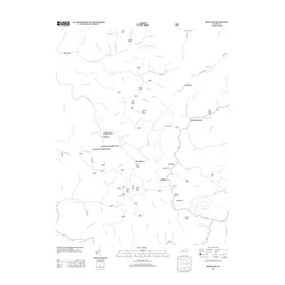
2013 Map of Mistletoe
USGS Topo · Published 2013About this map
Mistletoe and the surrounding hollows of Breathitt County are defined by a complex network of creeks and neighborhood clusters. The landscape is marked by unique community pockets such as Couch Town Neighborhood, Rockhouse Neighborhood, and Couch Fork Neighborhood. Transportation and social life follow the winding paths of Lucky Fork, Laurel Fork, and Middle Squabble, where the terrain dictates the settlement pattern. This 2013 survey illustrates the enduring nature of local place names, from the colorful Whoopflarea and Toenail Hollow to the high vantage point of Cherry Tree Lookout Tower on Cherry Tree Knob. Genealogists will find a wealth of family history in the numerous burial grounds documented here, including Morris Fork Cem, Riley Cem, and the uniquely named Loose Angel Cem.
Find a feature on this map
100 named features on this map. Tap any name to fly to it.
Don’t see what you’re looking for? This feature index may not catch every label — zoom into the map to look around manually.
Map Details
Editions of this 2013 Mistletoe Map
This is the sole edition of this map. No revisions or reprints were ever made.
Other maps of this area

1891 · Manchester
USGS Topo · 1:125,000

1891 · Hazard
USGS Topo · 1:125,000

1913 · Buckhorn
USGS Topo · 1:62,500

1916 · Hyden
USGS Topo · 1:48,000

1919 · Hyden
USGS Topo · 1:62,500

1953 · Buckhorn
USGS Topo · 1:24,000

1953 · Oneida
USGS Topo · 1:24,000

1953 · Cowcreek
USGS Topo · 1:24,000

1953 · Hyden West
USGS Topo · 1:24,000

1953 · Big Creek
USGS Topo · 1:24,000