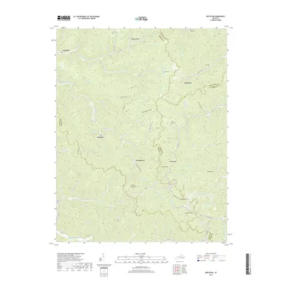
2019 Map of Mistletoe
USGS Topo · Published 2019About this map
Mistletoe and its surrounding hollows form a complex geography of ridges and creeks at the convergence of several Kentucky counties. The terrain is characterized by dozens of small drainages like Right Fork Buffalo Creek, Mill Timber Br, and Guy Camp Br, which have shaped the settlement patterns of the region. Local genealogy is well-represented by family-named landmarks such as Horn Hill Cem, Riley Cem, and Loose Angel Cem. Small communities like Whoopflarea, Doorway, and Dalesburg are scattered throughout this dissected landscape. Notable high points like Cherry Tree Knob and Bargers Knob provide orientation among the densely packed valleys. The presence of Still House Hollow and Bold Head Hollow hints at the traditional use and naming conventions of this pocket of the Cumberland Plateau.
Find a feature on this map
102 named features on this map. Tap any name to fly to it.
Don’t see what you’re looking for? This feature index may not catch every label — zoom into the map to look around manually.
Map Details
Editions of this 2019 Mistletoe Map
This is the sole edition of this map. No revisions or reprints were ever made.
Other maps of this area

1891 · Manchester
USGS Topo · 1:125,000

1891 · Hazard
USGS Topo · 1:125,000

1913 · Buckhorn
USGS Topo · 1:62,500

1916 · Hyden
USGS Topo · 1:48,000

1919 · Hyden
USGS Topo · 1:62,500

1953 · Buckhorn
USGS Topo · 1:24,000

1953 · Oneida
USGS Topo · 1:24,000

1953 · Cowcreek
USGS Topo · 1:24,000

1953 · Hyden West
USGS Topo · 1:24,000

1953 · Big Creek
USGS Topo · 1:24,000