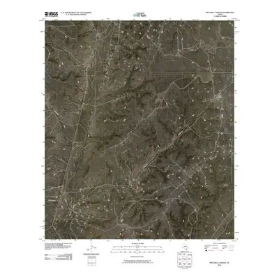
2010 Map of Mitchell Canyon
USGS Topo · Published 2010About this map
Mitchell Canyon and the expansive drainage systems of the West Texas plateau define this corner of Crockett County. In 2010, the landscape remains primarily dedicated to large-scale ranching, with the Mogul Ranch standing as a primary point of human settlement in an area dominated by dry washes and seasonal watercourses. The drainage patterns are clearly delineated by the confluence of Escondido Draw, Government Draw, and Howard Draw, which move runoff across the arid terrain. This topography illustrates the reliance on specific ranch locations and natural draws for navigation and land management in a region where water and infrastructure are sparse. The network of secondary roads and trails provides insight into how these remote ranching operations are interconnected across the canyon-cut landscape.
Find a feature on this map
5 named features on this map. Tap any name to fly to it.
Don’t see what you’re looking for? This feature index may not catch every label — zoom into the map to look around manually.
Map Details
Editions of this 2010 Mitchell Canyon Map
This is the sole edition of this map. No revisions or reprints were ever made.
Other maps of this area

1929 · Sheffield
USGS Topo · 1:125,000

1954 · Sonora
USGS Topo · 1:250,000

1958 · Sonora
USGS Topo · 1:250,000

1967 · Burnt Canyon
USGS Topo · 1:24,000

1967 · Pikes Peak
USGS Topo · 1:24,000

1967 · Hunt Ranch
USGS Topo · 1:24,000

1967 · Bachelor Hill
USGS Topo · 1:24,000
1967 · Mitchell Canyon NE
USGS Topo · 1:24,000

1967 · Mitchell Canyon
USGS Topo · 1:24,000

1970 · Howards Well NE
USGS Topo · 1:24,000