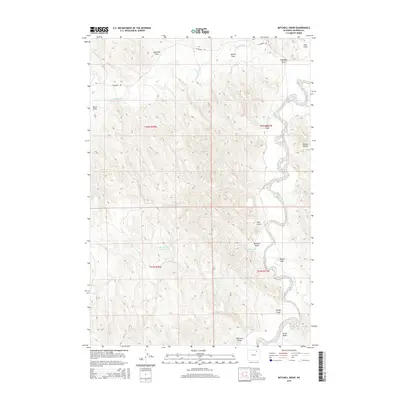
2015 Map of Mitchell Draw
USGS Topo · Published 2015About this map
The Powder River carves a winding path through this portion of Johnson County, defining a landscape of complex drainage systems and high divides. The terrain is characterized by a series of deep draws that feed into the river valley, including Mitchell Draw and Kinney Draw, which flank the prominent Kinney Divide. Water management in this semi-arid region is evident through the presence of several small impoundments, such as Henry Number 1 Reservoir, Mitchell Draw Reservoir, and Henry Reservoir.
Find a feature on this map
23 named features on this map. Tap any name to fly to it.
Don’t see what you’re looking for? This feature index may not catch every label — zoom into the map to look around manually.
Map Details
Editions of this 2015 Mitchell Draw Map
This is the sole edition of this map. No revisions or reprints were ever made.
Other maps of this area

1955 · Sheridan
USGS Topo · 1:250,000

1958 · Sheridan
USGS Topo · 1:250,000

1962 · Sheridan
USGS Topo · 1:250,000

1972 · Mitchell Draw
USGS Topo · 1:24,000
1972 · Bear Draw
USGS Topo · 1:24,000
1972 · Lariat
USGS Topo · 1:24,000
1972 · Jewell Draw
USGS Topo · 1:24,000
1972 · Somerville Flats West
USGS Topo · 1:24,000
1972 · Floate Draw
USGS Topo · 1:24,000
1972 · Arpan Butte
USGS Topo · 1:24,000