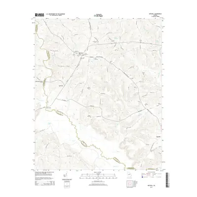
2014 Map of Mitchell
USGS Topo · Published 2014About this map
Mitchell serves as a central hub for this rural stretch of Glascock County, where the landscape is defined by the winding course of the Little Ogeechee River and numerous tributary creeks. The map reveals a dense network of family-named cemeteries, such as the Kitchens - Wilcher Cem and Llewellyn - Kitchens Cem, which offer significant value for genealogical research in this part of Georgia.
Find a feature on this map
92 named features on this map. Tap any name to fly to it.
Don’t see what you’re looking for? This feature index may not catch every label — zoom into the map to look around manually.
Map Details
Editions of this 2014 Mitchell Map
This is the sole edition of this map. No revisions or reprints were ever made.
Other maps of this area

1953 · Athens
USGS Topo · 1:250,000

1958 · Athens
USGS Topo · 1:250,000

1959 · Athens
USGS Topo · 1:250,000

1960 · Warthen NE
USGS Topo · 1:24,000

1961 · Warthen
USGS Topo · 1:24,000

1963 · Athens
USGS Topo · 1:250,000

1971 · Beall Springs
USGS Topo · 1:24,000
1972 · Downs
USGS Topo · 1:24,000
1972 · Bastonville
USGS Topo · 1:24,000
1972 · Gibson
USGS Topo · 1:24,000