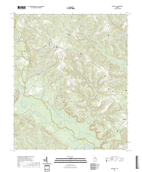
2024 Map of Mitchell
USGS Topo · Published 2024About this map
The Ogeechee River and its numerous tributaries, including Big Creek and Philcher Creek, carve a complex drainage pattern across this Glascock County landscape. The settlement of Mitchell serves as a central point, surrounded by a dense network of family and community burial grounds that speak to the deep genealogical roots of the area. Notable sites include the Kitchens - Wilcher Cem, Saint Paul Cem, and Friendship Cem. To the south and east, the map reveals smaller communities like Agricola and Edgehill, linked by a web of rural routes such as Mitchell Rd and Cason Pond Rd. The topography is further defined by several localized impoundments and wetlands, most notably Chalker Lake and Kents Millpond, illustrating how the local geography has been shaped by both natural watercourses and historic land use practices near the Washington and Jefferson County lines.
Find a feature on this map
95 named features on this map. Tap any name to fly to it.
Don’t see what you’re looking for? This feature index may not catch every label — zoom into the map to look around manually.
Map Details
Editions of this 2024 Mitchell Map
This is the sole edition of this map. No revisions or reprints were ever made.
Other maps of this area

1953 · Athens
USGS Topo · 1:250,000

1958 · Athens
USGS Topo · 1:250,000

1959 · Athens
USGS Topo · 1:250,000

1960 · Warthen NE
USGS Topo · 1:24,000

1961 · Warthen
USGS Topo · 1:24,000

1963 · Athens
USGS Topo · 1:250,000

1971 · Beall Springs
USGS Topo · 1:24,000
1972 · Downs
USGS Topo · 1:24,000
1972 · Bastonville
USGS Topo · 1:24,000
1972 · Gibson
USGS Topo · 1:24,000