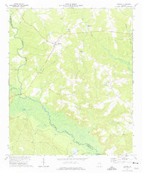
1972 Map of Mitchell
USGS Topo · Published 1975About this map
The Ogeechee River meanders across the rural boundary of Glascock and Washington counties, anchoring a landscape of scattered rural settlements and significant water features. The small town of Mitchell serves as a local hub, connected by roads to smaller communities like Agricola and Edgehill. The map details a social geography defined by local congregations, including Friendship Ch, Mt Nebo Ch, and Euphrates Ch, alongside numerous small cemeteries that offer critical data for genealogical research.
Find a feature on this map
30 named features on this map. Tap any name to fly to it.
Don’t see what you’re looking for? This feature index may not catch every label — zoom into the map to look around manually.
Map Details
Editions of this 1972 Mitchell Map
This is the sole edition of this map. No revisions or reprints were ever made.
Other maps of this area

1953 · Athens
USGS Topo · 1:250,000

1958 · Athens
USGS Topo · 1:250,000

1959 · Athens
USGS Topo · 1:250,000

1960 · Warthen NE
USGS Topo · 1:24,000

1961 · Warthen
USGS Topo · 1:24,000

1963 · Athens
USGS Topo · 1:250,000

1971 · Beall Springs
USGS Topo · 1:24,000
1972 · Downs
USGS Topo · 1:24,000
1972 · Bastonville
USGS Topo · 1:24,000
1972 · Gibson
USGS Topo · 1:24,000