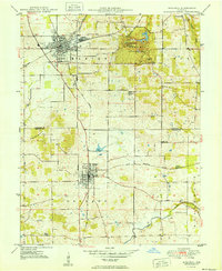
1950 Map of Mitchell
USGS Topo · Published 1950About this map
Spring Mill State Park serves as the focal point of this Southern Indiana landscape, preserving a distinct cluster of karst features including Hamer Cave, Donaldson Cave, and Twin Caves. The presence of Spring Mill Village within the park grounds reflects the area’s early industrial heritage, while the surrounding townships of Marion, Bono, and Orleans show a grid of agricultural development and local landmarks.
Find a feature on this map
26 named features on this map. Tap any name to fly to it.
Don’t see what you’re looking for? This feature index may not catch every label — zoom into the map to look around manually.
Map Details
Editions of this 1950 Mitchell Map
2 editions found
Other maps of this area

1934 · Bedford
USGS Topo · 1:48,000

1935 · Oolitic
USGS Topo · 1:48,000

1937 · Bedford
USGS Topo · 1:62,500

1942 · Oolitic
USGS Topo · 1:62,500

1949 · Georgia
USGS Topo · 1:24,000

1950 · Mitchell
USGS Topo · 1:24,000

1951 · French Lick
USGS Topo · 1:24,000

1951 · Georgia
USGS Topo · 1:24,000

1956 · Vincennes
USGS Topo · 1:250,000

1957 · Vincennes
USGS Topo · 1:250,000