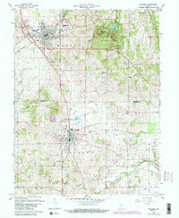
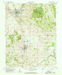
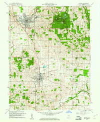
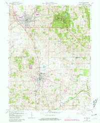
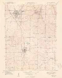
1960 Map of Mitchell
USGS Topo · Published 1989About this map
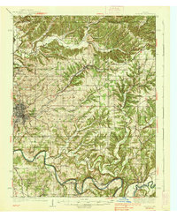
The intersection of the Baltimore and Ohio, Monon, and Louisville and Nashville railroads anchors this region of southern Indiana. The landscape is defined by the significant cave systems and karst features of Spring Mill State Park, which includes Donaldson Cave, Bronson Cave, and Twin Caves. These natural formations are accompanied by the historic reconstruction at Spring Mill Village and the Purdue Experimental Orchard. The diagonal line of the Indian Treaty Boundary cuts across the terrain, serving as a reminder of early frontier divisions between the townships of Marion, Bono, and Orleans. Further south, the town of Orleans is shown with its local landmarks, including the Orleans Airport and Fairview Cem, while the Lost River meanders through the southern portion of the quadrangle.
Find a feature on this map
41 named features on this map. Tap any name to fly to it.
Don’t see what you’re looking for? This feature index may not catch every label — zoom into the map to look around manually.
Map Details
Editions of this 1960 Mitchell Map
5 editions found
Other maps of this area
1934 · Bedford
USGS Topo · 1:48,000

1935 · Oolitic
USGS Topo · 1:48,000
1937 · Bedford
USGS Topo · 1:62,500

1942 · Oolitic
USGS Topo · 1:62,500
1949 · Georgia
USGS Topo · 1:24,000
1950 · Mitchell
USGS Topo · 1:24,000
1951 · French Lick
USGS Topo · 1:24,000
1951 · Georgia
USGS Topo · 1:24,000

1956 · Vincennes
USGS Topo · 1:250,000

1957 · Vincennes
USGS Topo · 1:250,000