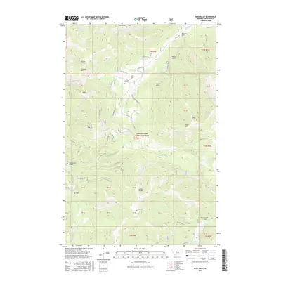
2017 Map of Mixes Baldy
USGS Topo · Published 2017About this map
Lewis & Clark National Forest encompasses the high-altitude terrain of the Little Belt Mountains, where the summit of Mixes Baldy stands as a prominent landmark. This 2017 survey details a landscape defined by deep drainages and sharp peaks, including Anderson Peak and Clendenin Mtn. The remote settlement of Lone Tree Park and the nearby Lone Tree Park Cem represent the sparse human footprint in this mountainous region. Local transportation is facilitated by the rugged Hughsville Rd and Lonetree Rd, which navigate the steep topography between Peterson Gulch and Frenchies Gulch. Numerous watercourses such as Dry Fork Belt Cr and Snow Cr drain the slopes of Butcherknife Mtn, illustrating the complex watershed that defines the eastern front of the range in Judith Basin County.
Find a feature on this map
50 named features on this map. Tap any name to fly to it.
Don’t see what you’re looking for? This feature index may not catch every label — zoom into the map to look around manually.
Map Details
Editions of this 2017 Mixes Baldy Map
This is the sole edition of this map. No revisions or reprints were ever made.
Other maps of this area

1886 · Little Belt Mts.
USGS Topo · 1:250,000

1890 · Fort Benton
USGS Topo · 1:250,000

1892 · Fort Benton
USGS Topo · 1:250,000

1894 · Little Belt Mts.
USGS Topo · 1:250,000

1897 · Fort Benton
USGS Topo · 1:250,000

1897 · Little Belt Mts.
USGS Topo · 1:250,000

1898 · Little Belt Mts.
USGS Topo · 1:250,000

1902 · Little Belt Mts.
USGS Topo · 1:250,000

1948 · White Sulphur Springs
USGS Topo · 1:250,000

1954 · Great Falls
USGS Topo · 1:250,000