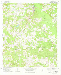
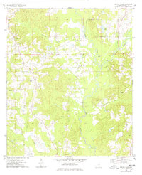
1975 Map of Mize
USGS Topo · Published 1978About this map
Sullivans Hollow serves as a geographic and cultural anchor in this portion of the Piney Woods during the mid-1970s. The town of Mize sits at the junction of the Illinois Central Gulf railroad and several local routes, its skyline marked by a Water Tank and the nearby Mize Lookout Tower. The landscape is characterized by a mix of agriculture and burgeoning industry, evidenced by an Oil Field near Oakohay Creek and numerous Gravel Pits scattered across the terrain.
Find a feature on this map
40 named features on this map. Tap any name to fly to it.
Don’t see what you’re looking for? This feature index may not catch every label — zoom into the map to look around manually.
Map Details
Editions of this 1975 Mize Map
This is the sole edition of this map. No revisions or reprints were ever made.
Other maps of this area

1953 · Hattiesburg
USGS Topo · 1:250,000

1958 · Hattiesburg
USGS Topo · 1:250,000
1965 · Hot Coffee
USGS Topo · 1:24,000
1974 · Lone Star
USGS Topo · 1:24,000
1974 · Collins
USGS Topo · 1:24,000
1975 · Cohay
USGS Topo · 1:24,000
1975 · Taylorsville
USGS Topo · 1:24,000
1975 · Magee North
USGS Topo · 1:24,000
1975 · Magee South
USGS Topo · 1:24,000
1975 · Center Ridge
USGS Topo · 1:24,000