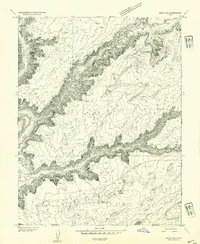
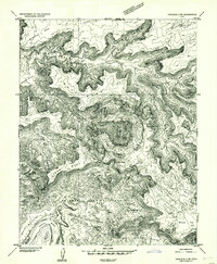
1952 Map of Moab 3 SW
USGS Topo · Published 1954About this map
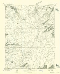
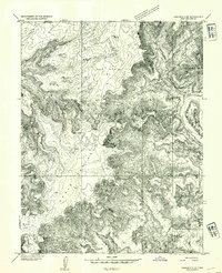
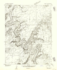
The Green River carves a deep, winding path through the desert plateau of eastern Utah, creating a series of isolated river flats and towering mesas. This 1952 topographic study highlights the dramatic elevation changes between the river basin and the high overlooks of Deadman Point and Horsethief Point. Along the riverbanks, distinct floodplain areas like Cottonwood Bottom, Mineral Bottom, and Woodruff Bottom represent the few accessible reaches in an otherwise vertical landscape. The map also documents vital water sources in this arid environment, including Horsethief Spring and several reservoirs. The deeply incised Mineral Canyon and Spring Canyon dominate the western half of the sheet, while the North Fork and South Fork drainage systems illustrate the complex erosional patterns typical of the region. The map captures the boundary between Emery, Grand, and San Juan counties during a period when the area remained largely inaccessible except by primitive roads.
Find a feature on this map
17 named features on this map. Tap any name to fly to it.
Don’t see what you’re looking for? This feature index may not catch every label — zoom into the map to look around manually.
Map Details
Editions of this 1952 Moab 3 SW Map
This is the sole edition of this map. No revisions or reprints were ever made.
Other maps of this area

1885 · San Rafael
USGS Topo · 1:250,000

1885 · La Sal
USGS Topo · 1:250,000
1951 · The Knoll
USGS Topo · 1:62,500
1951 · Upheaval Dome
USGS Topo · 1:62,500

1952 · Tidwell 4 SE
USGS Topo · 1:24,000
1952 · Moab 3 NE
USGS Topo · 1:24,000
1952 · Carlisle 2 NW
USGS Topo · 1:24,000
1952 · Moab 3 SE
USGS Topo · 1:24,000
1952 · Carlisle 2 NE
USGS Topo · 1:24,000
1952 · Tidwell 4 NE
USGS Topo · 1:24,000