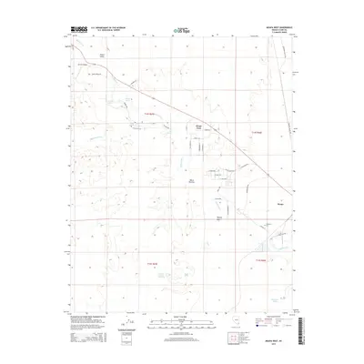
2015 Map of Moapa West
USGS Topo · Published 2015About this map
The Muddy River corridor anchors this portion of the Mojave Desert, where the ribbon of water sustains the settlements of Moapa Town and Moapa. The landscape is defined by the vital hydrology of the Moapa Valley, featuring numerous groundwater sources such as Warm Springs, Muddy Spring, and Livingston Number One Spring. These water points have historically dictated the patterns of human activity in this arid region.
Find a feature on this map
44 named features on this map. Tap any name to fly to it.
Don’t see what you’re looking for? This feature index may not catch every label — zoom into the map to look around manually.
Map Details
Editions of this 2015 Moapa West Map
This is the sole edition of this map. No revisions or reprints were ever made.
Other maps of this area

1886 · Saint Thomas
USGS Topo · 1:250,000

1893 · Saint Thomas
USGS Topo · 1:250,000

1954 · Las Vegas
USGS Topo · 1:250,000

1957 · Las Vegas
USGS Topo · 1:250,000

1958 · Arrow Canyon
USGS Topo · 1:62,500

1958 · Moapa
USGS Topo · 1:62,500

1959 · Las Vegas
USGS Topo · 1:250,000

1962 · Las Vegas
USGS Topo · 1:250,000

1969 · Farrier
USGS Topo · 1:24,000
1969 · Rox SE
USGS Topo · 1:24,000