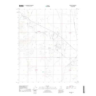
2018 Map of Moapa West
USGS Topo · Published 2018About this map
The Muddy River defines the geography of this northern Clark County landscape, supporting a chain of vital water sources in an arid environment. Springs are the primary landmarks for local history here, including Peterson Spring, Warm Springs, High Springs, and the Livingston Number One Spring. These water points trace the lower reaches of Moapa Valley and provided the essential foundation for early ranching and settlement in the region.
Find a feature on this map
46 named features on this map. Tap any name to fly to it.
Don’t see what you’re looking for? This feature index may not catch every label — zoom into the map to look around manually.
Map Details
Editions of this 2018 Moapa West Map
This is the sole edition of this map. No revisions or reprints were ever made.
Other maps of this area

1886 · Saint Thomas
USGS Topo · 1:250,000

1893 · Saint Thomas
USGS Topo · 1:250,000

1954 · Las Vegas
USGS Topo · 1:250,000

1957 · Las Vegas
USGS Topo · 1:250,000

1958 · Arrow Canyon
USGS Topo · 1:62,500

1958 · Moapa
USGS Topo · 1:62,500

1959 · Las Vegas
USGS Topo · 1:250,000

1962 · Las Vegas
USGS Topo · 1:250,000

1969 · Farrier
USGS Topo · 1:24,000
1969 · Rox SE
USGS Topo · 1:24,000