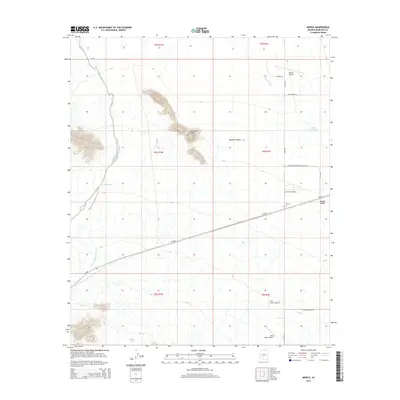
2014 Map of Mobile
USGS Topo · Published 2014About this map
Mobile and Mobile Valley anchor the eastern side of this desert landscape, situated along the path of Az-238. This 2014 survey reveals a transition from the drainage basins of Rainbow Valley to the prominent relief of Espanto Mtn, which rises as a distinct landmark near the center of the sheet. The area is defined by a sparse but intentional network of ranching and aviation infrastructure, including several private landing strips such as Schu Ranch Airport and Mel's Ranch Airport, alongside the larger Mobile Airport.
Find a feature on this map
27 named features on this map. Tap any name to fly to it.
Don’t see what you’re looking for? This feature index may not catch every label — zoom into the map to look around manually.
Map Details
Editions of this 2014 Mobile Map
This is the sole edition of this map. No revisions or reprints were ever made.
Other maps of this area

1913 · Maricopa
USGS Topo · 1:62,500

1915 · Maricopa
USGS Topo · 1:62,500

1946 · Antelope Peak
USGS Topo · 1:62,500

1948 · Antelope Peak
USGS Topo · 1:62,500

1951 · Estrella
USGS Topo · 1:62,500

1951 · Mobile
USGS Topo · 1:62,500

1952 · Montezuma Peak
USGS Topo · 1:24,000

1952 · Enid
USGS Topo · 1:24,000
1952 · Maricopa
USGS Topo · 1:62,500

1953 · Ajo
USGS Topo · 1:250,000