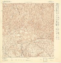
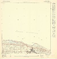
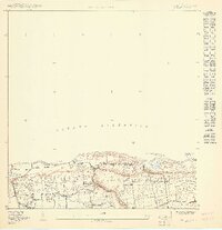
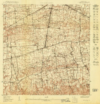
1950 Map of Moca SE
USGS Topo · Published 1950About this map
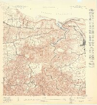
The northern Puerto Rican karst landscape transitions from the coastal plains into the rolling uplands of Aceitunas and Arenales Altos in this mid-century topographic study. Settlement patterns follow the winding roads and mountain ridges, with a concentration of activity at the Iglesia de la Virgen del Rosario near the eastern boundary. The intricate network of small farms and residences is particularly dense in the barrios of Rocha and Galateo Alto, illustrating the intensive rural land use of the era before significant urbanization. Terrain features like Monte Encantado and Cerro El Sombrero provide prominent landmarks among the labyrinth of sinkholes and mogotes characteristic of this region. Water resources, critical for these agricultural communities, are represented by the seasonal flows of Quebrada Lasalle and Quebrada Salto, which drain the complex topography toward the northern coast.
Find a feature on this map
18 named features on this map. Tap any name to fly to it.
Don’t see what you’re looking for? This feature index may not catch every label — zoom into the map to look around manually.
Map Details
Editions of this 1950 Moca SE Map
This is the sole edition of this map. No revisions or reprints were ever made.
Historical Maps of Salto Through Time
6 maps found
Featured Locations
- Moca
- Arenales Altos, Isabela
- Sector Domenech, San Sebastián
- Salto, San Sebastián
- Sector Villa Morales, San Sebastián