1950 Map of Isabela SE
USGS Topo · Published 1950About this map
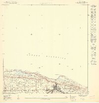
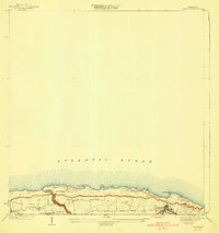
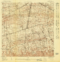
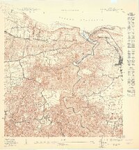
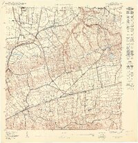
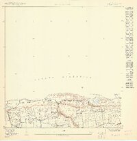
Isabela serves as the focal point of this coastal survey, where the town's grid meets the dramatic northern shoreline of the Océano Atlántico. The landscape is divided into the barrios of Bajura, Jobos, and Guayabos, reflecting the local administrative organization of mid-century Puerto Rico. The infrastructure of the era is defined by the route of the American R. R. of P. R., which parallels the coast, and local thoroughfares like the Camino Jobos. Topographical details highlight the elevation changes along the coast, specifically at prominent features such as Peña de los Pozos, Pta Sardina, and Punta Tuna. These coastal markers, combined with the dense concentration of individual structures in the town center, illustrate a community deeply tied to its geography and rail connections.
Find a feature on this map
10 named features on this map. Tap any name to fly to it.
Don’t see what you’re looking for? This feature index may not catch every label — zoom into the map to look around manually.
Map Details
Editions of this 1950 Isabela SE Map
This is the sole edition of this map. No revisions or reprints were ever made.
Other maps of this area

1937 · Moca
USGS Topo · 1:20,000

1938 · Quebradillas
USGS Topo · 1:20,000

1941 · Moca
USGS Topo · 1:30,000
1941 · Isabela
USGS Topo · 1:30,000

1942 · Moca
USGS Topo · 1:30,000
1950 · Moca NE
USGS Topo · 1:10,000
1950 · Quebradillas NO
USGS Topo · 1:10,000
1950 · Moca NO
USGS Topo · 1:10,000
1950 · Isabela SO
USGS Topo · 1:10,000
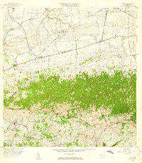
1956 · Moca
USGS Topo · 1:20,000
Featured Places
- Isabela, Isabela
- Jardín Miramar, Isabela
- Jardín de Noroeste, Isabela
- Barrio Pueblo, Isabela
- Bejucos, Isabela