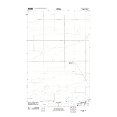
2011 Map of Moccasin
USGS Topo · Published 2011About this map
Moccasin serves as a central hub of this Judith Basin County landscape, established along the road network that connects the northern plains with the river valley to the south. The map documents a rural agricultural environment where water management is critical, evidenced by the presence of Murray Ditch and the Atlas Dam. To the south, the Judith River cuts through the terrain near the settlement of Hobson, which is supported by the Hobson Rural Vol Fire Dist. Local history and genealogy interest is anchored by the Moccasin Post Office and the Moccasin Cemetery located just south of the main townsite. The survey also captures the extensive grid of section-line roads, such as County Rd-327 and County Rd-308, which defined the division of land in this part of Montana into the early 21st century.
Find a feature on this map
18 named features on this map. Tap any name to fly to it.
Don’t see what you’re looking for? This feature index may not catch every label — zoom into the map to look around manually.
Map Details
Editions of this 2011 Moccasin Map
This is the sole edition of this map. No revisions or reprints were ever made.
Other maps of this area

1886 · Little Belt Mts.
USGS Topo · 1:250,000

1889 · Big Snowy Mountain
USGS Topo · 1:250,000

1890 · Fort Benton
USGS Topo · 1:250,000

1892 · Fort Benton
USGS Topo · 1:250,000

1893 · Big Snowy Mountain
USGS Topo · 1:250,000

1894 · Little Belt Mts.
USGS Topo · 1:250,000

1897 · Fort Benton
USGS Topo · 1:250,000

1897 · Little Belt Mts.
USGS Topo · 1:250,000

1898 · Little Belt Mts.
USGS Topo · 1:250,000

1902 · Little Belt Mts.
USGS Topo · 1:250,000