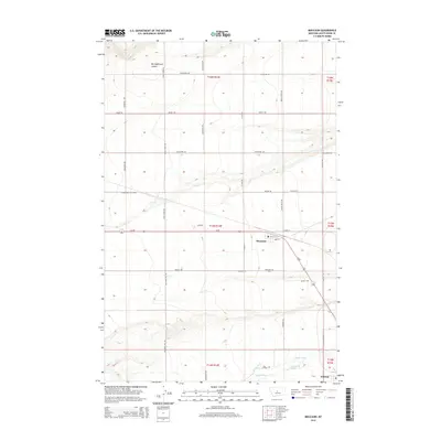
2014 Map of Moccasin
USGS Topo · Published 2014About this map
Moccasin and Hobson anchor this rural Montana landscape, reflecting the agricultural and topographical character of Judith Basin County in 2014. The terrain is defined by the prominent Silo Bench to the north and Macaroni Hill to the south, while Us-87 serves as the primary transportation artery connecting the settlements. Water management and drainage are central to the area's layout, visible in the winding path of the Judith River and the engineered Murray Ditch. Genealogists and local historians can locate the Moccasin Cem just south of its namesake town, while the surrounding grid of named roads like Stockfarm Rd and Indiana Rd provides a detailed framework for tracing local property and homesteading history. The map also captures smaller natural features such as Big Sagebrush Coulee and Louse Cr, which carve through the high plains.
Find a feature on this map
42 named features on this map. Tap any name to fly to it.
Don’t see what you’re looking for? This feature index may not catch every label — zoom into the map to look around manually.
Map Details
Editions of this 2014 Moccasin Map
This is the sole edition of this map. No revisions or reprints were ever made.
Other maps of this area

1886 · Little Belt Mts.
USGS Topo · 1:250,000

1889 · Big Snowy Mountain
USGS Topo · 1:250,000

1890 · Fort Benton
USGS Topo · 1:250,000

1892 · Fort Benton
USGS Topo · 1:250,000

1893 · Big Snowy Mountain
USGS Topo · 1:250,000

1894 · Little Belt Mts.
USGS Topo · 1:250,000

1897 · Fort Benton
USGS Topo · 1:250,000

1897 · Little Belt Mts.
USGS Topo · 1:250,000

1898 · Little Belt Mts.
USGS Topo · 1:250,000

1902 · Little Belt Mts.
USGS Topo · 1:250,000