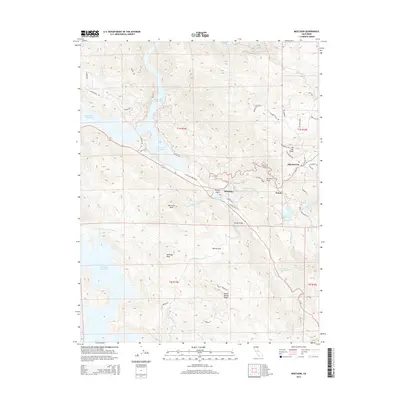
2015 Map of Moccasin
USGS Topo · Published 2015About this map
The Hetch Hetchy Aqueduct cuts a strategic path through this segment of Tuolumne County, tracing the complex water infrastructure that serves distant municipalities. This 2015 survey illustrates the modern landscape around the settlements of Moccasin, Priest, and Big Oak Flat, where the steep topography of the Sierra foothills dictates the winding routes of Old Priest Grade and Priest Grade. The relationship between terrain and water management is central to the area's character, evidenced by the proximity of Don Pedro Reservoir, Moccasin Reservoir, and Priest Reservoir. Notable elevations like Moccasin Peak and the sprawling Peñon Blanco Ridge overlook historic flats and drainages including Marshs Flat and Grizzly Gulch, offering a detailed perspective on a region defined by its role in California's hydraulic history and its enduring Gold Country settlements.
Find a feature on this map
51 named features on this map. Tap any name to fly to it.
Don’t see what you’re looking for? This feature index may not catch every label — zoom into the map to look around manually.
Map Details
Editions of this 2015 Moccasin Map
This is the sole edition of this map. No revisions or reprints were ever made.
Other maps of this area

1893 · Sonora
USGS Topo · 1:125,000

1896 · Sonora
USGS Topo · 1:125,000

1897 · Sonora
USGS Topo · 1:125,000

1898 · Sonora
USGS Topo · 1:125,000

1915 · La Grange
USGS Topo · 1:24,000

1919 · La Grange
USGS Topo · 1:31,680

1944 · Merced Falls
USGS Topo · 1:62,500

1947 · San Jose
USGS Topo · 1:250,000

1947 · Coulterville
USGS Topo · 1:62,500
1947 · Chinese Camp
USGS Topo · 1:24,000