
1947 Map of Coulterville
USGS Topo · Published 1953About this map
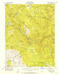
Gold mining operations and cattle ranching define this section of the Mother Lode shortly after World War II. The landscape is marked by dozens of claims, from the Bondurant Mine in the north to the Mt Gaines Mine and Number Nine Mine near Hornitos. Mining infrastructure is everywhere, with Tailings and sites like the Mary Harrison Mine and Virginia Mine reflecting decades of hard-rock extraction. Along the Merced River, the Gaging Sta and early development of Lake McClure and the Exchequer Reservoir signal the growing importance of water management for the Central Valley.
Find a feature on this map
110 named features on this map. Tap any name to fly to it.
Don’t see what you’re looking for? This feature index may not catch every label — zoom into the map to look around manually.
Map Details
Editions of this 1947 Coulterville Map
4 editions found
Other maps of this area

1893 · Sonora
USGS Topo · 1:125,000

1896 · Sonora
USGS Topo · 1:125,000

1897 · Sonora
USGS Topo · 1:125,000

1897 · Yosemite
USGS Topo · 1:125,000

1898 · Sonora
USGS Topo · 1:125,000

1900 · Yosemite
USGS Topo · 1:125,000

1903 · Yosemite
USGS Topo · 1:125,000

1909 · Yosemite
USGS Topo · 1:125,000

1912 · Mariposa
USGS Topo · 1:125,000

1916 · Merced Falls
USGS Topo · 1:24,000