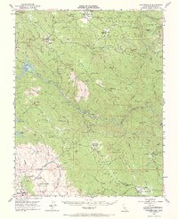
1947 Map of Coulterville
USGS Topo · Published 1968About this map
The Merced River cuts a deep gorge through this portion of Mariposa County, anchoring a landscape defined by California's mid-century mining legacy. This 1947 field survey records the intricate network of hard-rock operations along the Mother Lode, ranging from the Mary Harrison Mine near Coulterville to the Red Cloud Mines in the south. The transition from the high ridges of the Stanislaus National Forest down to the lower foothills near Hornitos reveals a settlement pattern built entirely on mineral extraction and water access.
Find a feature on this map
109 named features on this map. Tap any name to fly to it.
Don’t see what you’re looking for? This feature index may not catch every label — zoom into the map to look around manually.
Map Details
Editions of this 1947 Coulterville Map
4 editions found

Other maps of this area

1893 · Sonora
USGS Topo · 1:125,000

1896 · Sonora
USGS Topo · 1:125,000

1897 · Sonora
USGS Topo · 1:125,000

1897 · Yosemite
USGS Topo · 1:125,000

1898 · Sonora
USGS Topo · 1:125,000

1900 · Yosemite
USGS Topo · 1:125,000

1903 · Yosemite
USGS Topo · 1:125,000

1909 · Yosemite
USGS Topo · 1:125,000

1912 · Mariposa
USGS Topo · 1:125,000

1916 · Merced Falls
USGS Topo · 1:24,000