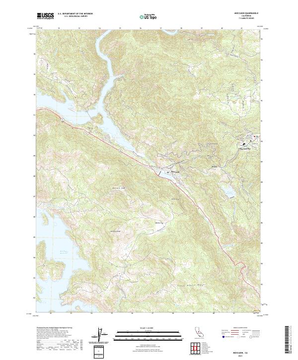
2021 Map of Moccasin
USGS Topo · Published 2021About this map
Big Oak Flat and the surrounding Tuolumne County landscape showcase a complex network of water infrastructure and early California heritage. The map highlights the massive scale of the Hetch Hetchy Aqueduct and the Don Pedro Reservoir, illustrating the mid-century engineering required to manage the Sierra Nevada's water resources. In the settlement of Big Oak Flat, several historic burial grounds are preserved, including the Citizens Cem, Our Lady of Mount Carmel Cem, and the Big Oak Flat Chinese Cem, which points to the diverse ethnic makeup of the region's mining and labor history.
Find a feature on this map
60 named features on this map. Tap any name to fly to it.
Don’t see what you’re looking for? This feature index may not catch every label — zoom into the map to look around manually.
Map Details
Editions of this 2021 Moccasin Map
This is the sole edition of this map. No revisions or reprints were ever made.
Other maps of this area

1893 · Sonora
USGS Topo · 1:125,000

1896 · Sonora
USGS Topo · 1:125,000

1897 · Sonora
USGS Topo · 1:125,000

1898 · Sonora
USGS Topo · 1:125,000

1915 · La Grange
USGS Topo · 1:24,000

1919 · La Grange
USGS Topo · 1:31,680

1944 · Merced Falls
USGS Topo · 1:62,500

1947 · San Jose
USGS Topo · 1:250,000

1947 · Coulterville
USGS Topo · 1:62,500
1947 · Chinese Camp
USGS Topo · 1:24,000