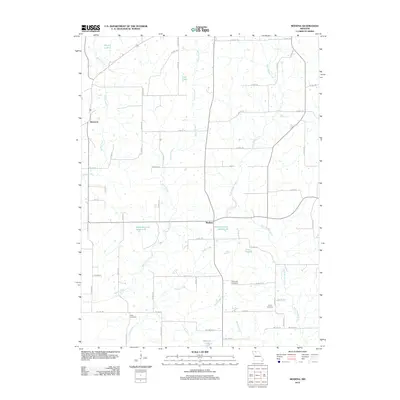
2012 Map of Modena
USGS Topo · Published 2012About this map
Modena serves as a central hub for this rural Mercer County landscape, where a dense network of county highways connects scattered agricultural holdings and small water bodies. The terrain is defined by the winding paths of West Muddy Creek and Martin Creek, which dictate the placement of local roads and property boundaries. For those researching family history, the map preserves the locations of several burial grounds, including Union Cemetery near the eastern edge and Brummitt Cemetery to the south.
Find a feature on this map
63 named features on this map. Tap any name to fly to it.
Don’t see what you’re looking for? This feature index may not catch every label — zoom into the map to look around manually.
Map Details
Editions of this 2012 Modena Map
This is the sole edition of this map. No revisions or reprints were ever made.
Other maps of this area

1925 · Gilman
USGS Topo · 1:62,500

1946 · Gilman
USGS Topo · 1:48,000

1946 · Princeton
USGS Topo · 1:62,500

1947 · Blythedale
USGS Topo · 1:62,500

1948 · Gilman
USGS Topo · 1:62,500

1948 · Princeton
USGS Topo · 1:62,500

1948 · Trenton
USGS Topo · 1:62,500

1954 · Centerville
USGS Topo · 1:250,000

1957 · Centerville
USGS Topo · 1:250,000

1958 · Centerville
USGS Topo · 1:250,000