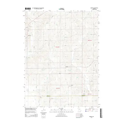
2014 Map of Modena
USGS Topo · Published 2014About this map
Modena and Dinsmore sit within a landscape defined by the drainage basins of northern Missouri, where the Mercer Co Grundy Co border divides the southern reaches of this survey. The terrain is characterized by a dense network of water features, including King Lake, Dean Lake, and the specifically designated Hamilton Lake Section 33 and Hamilton Lake Section 35. Numerous tributaries like Sandy Cr, Martin Cr, and W Muddy Cr carve through the agricultural lands, creating a series of ridges and valleys that have historically influenced the placement of local homesteads and access roads. For genealogists, the map preserves the exact locations of several burial grounds, including Brummitt Cemetery and Union Cemetery near the county line, and Wild Cemetery to the west. The road network follows a distinct alphabetical and thematic nomenclature, with routes ranging from Iceberg Rd to Kangaroo Ave.
Find a feature on this map
58 named features on this map. Tap any name to fly to it.
Don’t see what you’re looking for? This feature index may not catch every label — zoom into the map to look around manually.
Map Details
Editions of this 2014 Modena Map
This is the sole edition of this map. No revisions or reprints were ever made.
Other maps of this area

1925 · Gilman
USGS Topo · 1:62,500

1946 · Gilman
USGS Topo · 1:48,000

1946 · Princeton
USGS Topo · 1:62,500

1947 · Blythedale
USGS Topo · 1:62,500

1948 · Gilman
USGS Topo · 1:62,500

1948 · Princeton
USGS Topo · 1:62,500

1948 · Trenton
USGS Topo · 1:62,500

1954 · Centerville
USGS Topo · 1:250,000

1957 · Centerville
USGS Topo · 1:250,000

1958 · Centerville
USGS Topo · 1:250,000