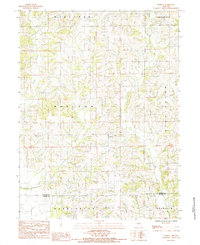
1984 Map of Modena
USGS Topo · Published 1985About this map
The unincorporated settlement of Modena serves as a central point in this 1980s landscape, positioned near the crossroads of agricultural townships and the Mercer Co Grundy Co line. The terrain is defined by a dense network of drainage systems, including the southward-flowing Sandy Creek, Marlin Creek, and West Muddy Creek. These waterways dictate the local topography and the placement of rural roads, which largely follow the ridge lines between the deep creek beds. Evidence of modern infrastructure is sparse, noted primarily by a Radio Tower standing as a landmark in the northern section of the survey. The map details the transition between several jurisdictional boundaries such as Madison and Harrison townships, providing a clear view of land organization in north-central Missouri during this era before significant digital revision.
Find a feature on this map
13 named features on this map. Tap any name to fly to it.
Don’t see what you’re looking for? This feature index may not catch every label — zoom into the map to look around manually.
Map Details
Editions of this 1984 Modena Map
This is the sole edition of this map. No revisions or reprints were ever made.
Other maps of this area

1925 · Gilman
USGS Topo · 1:62,500

1946 · Gilman
USGS Topo · 1:48,000

1946 · Princeton
USGS Topo · 1:62,500

1947 · Blythedale
USGS Topo · 1:62,500

1948 · Gilman
USGS Topo · 1:62,500

1948 · Princeton
USGS Topo · 1:62,500

1948 · Trenton
USGS Topo · 1:62,500

1954 · Centerville
USGS Topo · 1:250,000

1957 · Centerville
USGS Topo · 1:250,000

1958 · Centerville
USGS Topo · 1:250,000