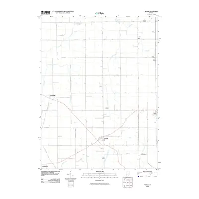
2010 Map of Modoc
USGS Topo · Published 2010About this map
The town of Losantville serves as a central hub on this Indiana landscape, where intersecting transit routes link the smaller settlements of Modoc, Blountsville, and Mooreland. The terrain is defined by a dense network of headwaters and creeks, including Stoney Creek in the northwest and Nettle Creek to the south. This 2010 survey by the U.S. Geological Survey provides a precise view of rural Henry and Randolph Counties, documenting numerous family and community burial sites such as Poplar Run Cemetery, Riverside Cemetery, and Gable Cemetery. The map also captures the lingering traces of local hamlets like Pinch and Scott Corner, alongside historical thoroughfares such as Indian Trail Rd. The drainage pattern of Little White River and Wilbur Wright Creek underscores the agricultural character of the region, while the grid-like road system illustrates the late-twentieth-century development of this Midwestern farming corridor.
Find a feature on this map
40 named features on this map. Tap any name to fly to it.
Don’t see what you’re looking for? This feature index may not catch every label — zoom into the map to look around manually.
Map Details
Editions of this 2010 Modoc Map
This is the sole edition of this map. No revisions or reprints were ever made.
Other maps of this area

1950 · New Castle East
USGS Topo · 1:24,000

1952 · Maxville
USGS Topo · 1:24,000

1952 · Muncie East
USGS Topo · 1:24,000

1952 · Farmland
USGS Topo · 1:24,000

1953 · Cincinnati
USGS Topo · 1:250,000

1953 · Muncie
USGS Topo · 1:250,000

1956 · Muncie
USGS Topo · 1:250,000

1957 · Cincinnati
USGS Topo · 1:250,000

1960 · New Castle East
USGS Topo · 1:24,000

1960 · Mount Pleasant
USGS Topo · 1:24,000