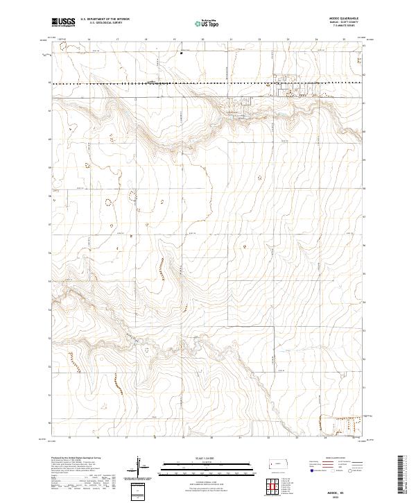
2022 Map of Modoc
USGS Topo · Published 2022About this map
Modoc stands as a quiet anchor in western Scott County, situated along a vast grid of section roads that define this agricultural landscape. The township structure is clearly marked through t18s r34w and t18s r33w, illustrating the geometric precision of the Public Land Survey System in Kansas. A significant local landmark for genealogists and family historians is the Modoc Cem, located north of the primary settlement area near W RD 160. The terrain is shaped by intermittent drainage systems, notably the path of Lion Cr and the winding course of Rocky Draw to the south. These features reveal the natural hydrology of the plains, where small draws and creeks break the otherwise flat horizon. Roads like S Cherokee Rd and S Apache Rd connect scattered farmsteads, reflecting a rural economy built on large-scale land management and seasonal water sources.
Find a feature on this map
23 named features on this map. Tap any name to fly to it.
Don’t see what you’re looking for? This feature index may not catch every label — zoom into the map to look around manually.
Map Details
Editions of this 2022 Modoc Map
This is the sole edition of this map. No revisions or reprints were ever made.
Other maps of this area

1939 · Sandon
USGS Topo · 1:62,500

1939 · Pence
USGS Topo · 1:62,500

1940 · Scott City
USGS Topo · 1:62,500

1941 · Modoc
USGS Topo · 1:62,500

1941 · Pence
USGS Topo · 1:62,500

1942 · Sandon
USGS Topo · 1:62,500

1951 · Scott City
USGS Topo · 1:62,500

1951 · Modoc
USGS Topo · 1:62,500

1955 · Scott City
USGS Topo · 1:250,000

1958 · Scott City
USGS Topo · 1:250,000