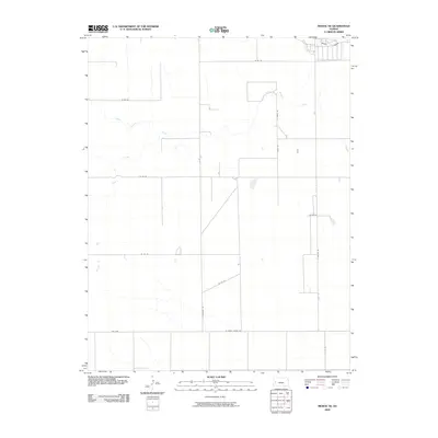
2009 Map of Modoc SE
USGS Topo · Published 2009About this map
White Woman Creek meanders across the high plains of Finney County, defining the drainage patterns of this agricultural landscape in western Kansas. The terrain is characterized by broad ephemeral watercourses like Sand Creek and Rocky Draw, which cross a regular grid of section-line roads. This network of thoroughfares, including S Cherokee Rd and W Finney Scott Rd, reflects the systematic land divisions established for large-scale farming and ranching operations. The road system is further structured by north-south arteries like S Eagle Rd and S Falcon Rd, which provide access to scattered rural farmsteads and agricultural plots. The inclusion of Fas 1679 highlights the integration of local routes into the Federal Aid Secondary highway system, facilitating the movement of goods in this corner of the state during the early 21st century.
Find a feature on this map
15 named features on this map. Tap any name to fly to it.
Don’t see what you’re looking for? This feature index may not catch every label — zoom into the map to look around manually.
Map Details
Editions of this 2009 Modoc SE Map
This is the sole edition of this map. No revisions or reprints were ever made.
Other maps of this area

1940 · Scott City
USGS Topo · 1:62,500

1941 · Modoc
USGS Topo · 1:62,500

1944 · Tennis
USGS Topo · 1:62,500

1951 · Scott City
USGS Topo · 1:62,500

1951 · Modoc
USGS Topo · 1:62,500

1955 · Scott City
USGS Topo · 1:250,000

1958 · Scott City
USGS Topo · 1:250,000

1965 · Wolf NW
USGS Topo · 1:24,000

1965 · Wolf NE
USGS Topo · 1:24,000
1976 · Modoc SW
USGS Topo · 1:24,000