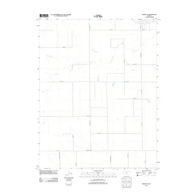
2012 Map of Modoc SE
USGS Topo · Published 2012About this map
The seasonal waters of White Woman Cr and Sand Cr define this agricultural expanse in Finney County during the early 21st century. The landscape is organized by an exacting grid of section roads, including W Road 70 and W Road 10, reflecting the long-term impact of the Public Land Survey System on the Kansas plains. This survey documents a sparsely populated rural district where the human imprint is primarily visible through a network of arterial routes such as S Cherokee Rd and S Falcon Rd. The transition between political boundaries is noted by N Kearny Co Line Rd, marking the western edge of the quadrangle. For researchers, the map provides a clear look at the drainage patterns and land-use divisions that characterized this portion of the High Plains before modern technological shifts in regional irrigation and land management.
Find a feature on this map
20 named features on this map. Tap any name to fly to it.
Don’t see what you’re looking for? This feature index may not catch every label — zoom into the map to look around manually.
Map Details
Editions of this 2012 Modoc SE Map
This is the sole edition of this map. No revisions or reprints were ever made.
Other maps of this area

1940 · Scott City
USGS Topo · 1:62,500

1941 · Modoc
USGS Topo · 1:62,500

1944 · Tennis
USGS Topo · 1:62,500

1951 · Scott City
USGS Topo · 1:62,500

1951 · Modoc
USGS Topo · 1:62,500

1955 · Scott City
USGS Topo · 1:250,000

1958 · Scott City
USGS Topo · 1:250,000

1965 · Wolf NW
USGS Topo · 1:24,000

1965 · Wolf NE
USGS Topo · 1:24,000
1976 · Modoc SW
USGS Topo · 1:24,000