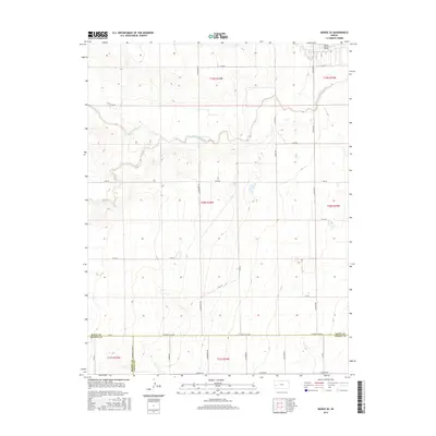
2015 Map of Modoc SE
USGS Topo · Published 2015About this map
White Woman Cr meanders across this High Plains landscape where the borders of Finney, Scott, and Kearny counties meet. The terrain is defined by a rhythmic grid of agricultural section lines and rural routes such as W Finney Scott Rd and W Friend Rd. These roads provide the primary structure for the region's ranching and farming operations, following the Public Land Survey System divisions of Township 19 South through Township 21 South. Aside from the prominent drainage of the creek, the map shows smaller intermittent water features like Sand Cr and Rocky Draw. This 2015 survey illustrates a contemporary view of Western Kansas, where the permanence of the cadastral grid contrasts with the seasonal nature of the local waterways.
Find a feature on this map
32 named features on this map. Tap any name to fly to it.
Don’t see what you’re looking for? This feature index may not catch every label — zoom into the map to look around manually.
Map Details
Editions of this 2015 Modoc SE Map
This is the sole edition of this map. No revisions or reprints were ever made.
Other maps of this area

1940 · Scott City
USGS Topo · 1:62,500

1941 · Modoc
USGS Topo · 1:62,500

1944 · Tennis
USGS Topo · 1:62,500

1951 · Scott City
USGS Topo · 1:62,500

1951 · Modoc
USGS Topo · 1:62,500

1955 · Scott City
USGS Topo · 1:250,000

1958 · Scott City
USGS Topo · 1:250,000

1965 · Wolf NW
USGS Topo · 1:24,000

1965 · Wolf NE
USGS Topo · 1:24,000
1976 · Modoc SW
USGS Topo · 1:24,000