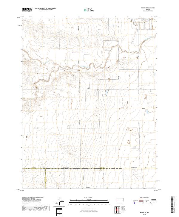
2022 Map of Modoc SE
USGS Topo · Published 2022About this map
The high plains of western Kansas converge where three counties—Scott, Kearny, and Finney—meet in a sparsely populated landscape defined by vast agricultural sections and intermittent drainage. White Woman Cr meanders across the northern half of the quadrangle, while Sand Cr carves through the western reaches, illustrating the natural watercourses that dictated early land use in this semi-arid region. The land is organized by a strict grid of section lines and gravel roads such as W Rd 70 and S Cherokee Rd, which provide access to the remote farmsteads that dot the prairie. The boundary markers for t20s r34w and surrounding townships underscore the importance of the Public Land Survey System in organizing the territory. This documentation captures the modern rural infrastructure, including namesake county boundary roads like W Finney Scott Rd and N Kearny Co Line Rd, which serve as vital arteries for the agricultural economy.
Find a feature on this map
31 named features on this map. Tap any name to fly to it.
Don’t see what you’re looking for? This feature index may not catch every label — zoom into the map to look around manually.
Map Details
Editions of this 2022 Modoc SE Map
This is the sole edition of this map. No revisions or reprints were ever made.
Other maps of this area

1940 · Scott City
USGS Topo · 1:62,500

1941 · Modoc
USGS Topo · 1:62,500

1944 · Tennis
USGS Topo · 1:62,500

1951 · Scott City
USGS Topo · 1:62,500

1951 · Modoc
USGS Topo · 1:62,500

1955 · Scott City
USGS Topo · 1:250,000

1958 · Scott City
USGS Topo · 1:250,000

1965 · Wolf NW
USGS Topo · 1:24,000

1965 · Wolf NE
USGS Topo · 1:24,000
1976 · Modoc SW
USGS Topo · 1:24,000