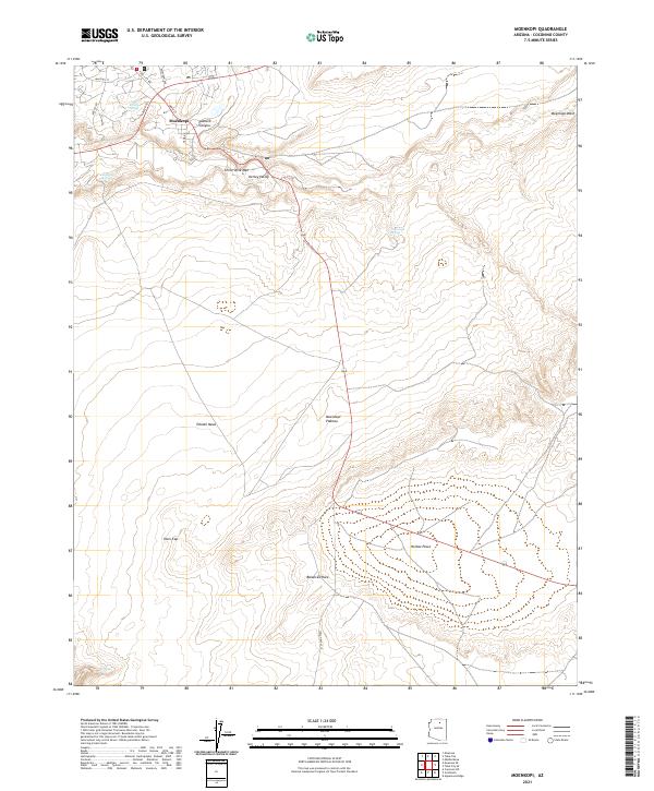
2021 Map of Moenkopi
USGS Topo · Published 2021About this map
Moenkopi serves as the focal point of this high-desert plateau, situated where local street networks like Main St and Peshlakai Ave meet the open terrain of Kerley Valley. The landscape is defined by its water sources and prominent geological markers, including John Etsitty Spring and Goldtooth Spring, which provide critical reference points in an otherwise arid environment. The map details a complex vertical geography, rising from the Moenkopi Wash up to the expansive Moenkopi Plateau and Tohnali Mesa. Distinctive natural landmarks such as Balanced Rock, Owls Cap, and the Three Wise Men formation highlight the unique erosional features of the Coconino County backcountry. The arrangement of springs and canyons like Pasture Canyon suggests a long-standing reliance on these specific natural catchments for survival and travel in the region.
Find a feature on this map
28 named features on this map. Tap any name to fly to it.
Don’t see what you’re looking for? This feature index may not catch every label — zoom into the map to look around manually.
Map Details
Editions of this 2021 Moenkopi Map
This is the sole edition of this map. No revisions or reprints were ever made.
Other maps of this area

1886 · San Francisco Mtns
USGS Topo · 1:250,000

1886 · Echo Cliffs
USGS Topo · 1:250,000

1891 · San Francisco Mtns
USGS Topo · 1:250,000

1891 · Echo Cliffs
USGS Topo · 1:250,000

1894 · San Francisco Mtns
USGS Topo · 1:250,000

1899 · San Francisco Mtns
USGS Topo · 1:250,000

1947 · Flagstaff
USGS Topo · 1:250,000

1954 · Flagstaff
USGS Topo · 1:250,000

1955 · Cameron
USGS Topo · 1:62,500

1956 · Marble Canyon
USGS Topo · 1:250,000