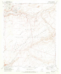
1969 Map of Moenkopi
USGS Topo · Published 1972About this map
Moenkopi serves as the focal point of this high-desert landscape within the Navajo Indian Reservation, where the community’s infrastructure includes sewage disposal ponds and several water sources. The terrain is defined by the carved path of Moenkopi Wash and the surrounding Kerley Valley, punctuated by landmarks such as Owls Cap and the geological formation at Balanced Rock. Local history is visible through scattered habitations like Tahniti and the evocative rock formation known as Three Wise Men. Remote desert infrastructure is captured by a network of pipelines, jeep trails, and several strategically located corrals. This survey illustrates a desert environment where water is a precious commodity, evidenced by named sites like John Elsity Spring, Ironwood Springs, and Crater Well which supported the area's agricultural and pastoral life in the late 1960s.
Find a feature on this map
33 named features on this map. Tap any name to fly to it.
Don’t see what you’re looking for? This feature index may not catch every label — zoom into the map to look around manually.
Map Details
Editions of this 1969 Moenkopi Map
This is the sole edition of this map. No revisions or reprints were ever made.
Other maps of this area

1886 · San Francisco Mtns
USGS Topo · 1:250,000

1886 · Echo Cliffs
USGS Topo · 1:250,000

1891 · San Francisco Mtns
USGS Topo · 1:250,000

1891 · Echo Cliffs
USGS Topo · 1:250,000

1894 · San Francisco Mtns
USGS Topo · 1:250,000

1899 · San Francisco Mtns
USGS Topo · 1:250,000

1947 · Flagstaff
USGS Topo · 1:250,000

1954 · Flagstaff
USGS Topo · 1:250,000

1955 · Cameron
USGS Topo · 1:62,500

1956 · Marble Canyon
USGS Topo · 1:250,000