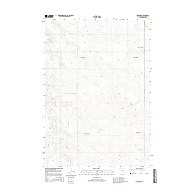
2015 Map of Moenville
USGS Topo · Published 2015About this map
Moenville serves as the primary landmark in this rural South Dakota landscape, situated within a topography defined by complex drainage networks. The area is dominated by the seasonal paths of E Fork Plum Cr, Crooked Cr, and the notably named Hermaphrodite Cr. These waterways carve through the terrain, leading toward larger features like Stony Butte Draw in the east. The map illustrates a high-plains environment where the section lines of the Public Land Survey System dictate the placement of roads like Manilla Rd and 203rd St. This grid-based development pattern highlights how early 20th-century land distribution continues to shape modern access and settlement in Haakon County. Collectors and researchers can trace the relationship between these section-line routes and the natural depressions of Deer Cr and Deep Cr as they converge across the landscape.
Find a feature on this map
15 named features on this map. Tap any name to fly to it.
Don’t see what you’re looking for? This feature index may not catch every label — zoom into the map to look around manually.
Map Details
Editions of this 2015 Moenville Map
This is the sole edition of this map. No revisions or reprints were ever made.
Other maps of this area

1954 · Pierre
USGS Topo · 1:250,000

1956 · Kirley
USGS Topo · 1:24,000

1956 · Cherry Creek
USGS Topo · 1:24,000

1958 · Pierre
USGS Topo · 1:250,000

1982 · Whiteman Ranch
USGS Topo · 1:24,000

1982 · May Ranch
USGS Topo · 1:24,000

1983 · Bentley Ranch
USGS Topo · 1:24,000

1983 · Mule Creek
USGS Topo · 1:24,000

1983 · Philip
USGS Topo · 1:100,000

1983 · Moenville
USGS Topo · 1:24,000