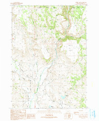
1990 Map of Moffit Table
USGS Topo · Published 1991About this map
The Malheur River cuts a deep valley through this portion of Harney County, dividing the high plateau of Moffit Table from the slopes of Battle Mountain. This landscape is defined by its water management and sparse upland infrastructure, where numerous seasonal water sources like Big Spring and Seep Spring are critical to the local rangeland. The presence of a Feed Lot and a Borrow Pit near the intersection of Van Drewsey Road and Robbins Road suggests an area primarily dedicated to cattle ranching and road maintenance during the late 20th century.
Find a feature on this map
28 named features on this map. Tap any name to fly to it.
Don’t see what you’re looking for? This feature index may not catch every label — zoom into the map to look around manually.
Map Details
Editions of this 1990 Moffit Table Map
This is the sole edition of this map. No revisions or reprints were ever made.
Other maps of this area

1908 · Ironside Mountain
USGS Topo · 1:125,000

1955 · Burns
USGS Topo · 1:250,000

1955 · Canyon City
USGS Topo · 1:250,000

1958 · Burns
USGS Topo · 1:250,000

1959 · Burns
USGS Topo · 1:250,000

1959 · Canyon City
USGS Topo · 1:250,000

1961 · Logan Valley
USGS Topo · 1:62,500

1968 · Drewsey
USGS Topo · 1:62,500

1968 · Van
USGS Topo · 1:62,500

1970 · Flag Prairie
USGS Topo · 1:62,500