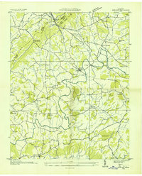
1935 Map of Mohawk
USGS Topo · Published 1935About this map
Lick Creek and its many tributaries, including Mink Creek and Pond Creek, dominate this rural Tennessee landscape at the junction of Greene, Hamblen, and Hawkins counties. The Southern railroad line cuts through the northern terrain, serving the village of Mohawk and the prominent topographic pass at Bulls Gap. Milling operations are central to the local economy, evidenced by the Mohawk Roller Mill and Darrow Mill located along the watercourses.
Find a feature on this map
53 named features on this map. Tap any name to fly to it.
Don’t see what you’re looking for? This feature index may not catch every label — zoom into the map to look around manually.
Map Details
Editions of this 1935 Mohawk Map
This is the sole edition of this map. No revisions or reprints were ever made.
Other maps of this area

1883 · Morristown
USGS Topo · 1:125,000

1892 · Greeneville
USGS Topo · 1:125,000

1893 · Morristown
USGS Topo · 1:125,000

1895 · Morristown
USGS Topo · 1:125,000

1896 · Greeneville
USGS Topo · 1:125,000

1904 · Greeneville
USGS Topo · 1:125,000

1935 · Surgoinsville
USGS Topo · 1:48,000

1935 · Rogersville
USGS Topo · 1:48,000

1935 · Parrottsville
USGS Topo · 1:24,000

1935 · McCloud
USGS Topo · 1:24,000