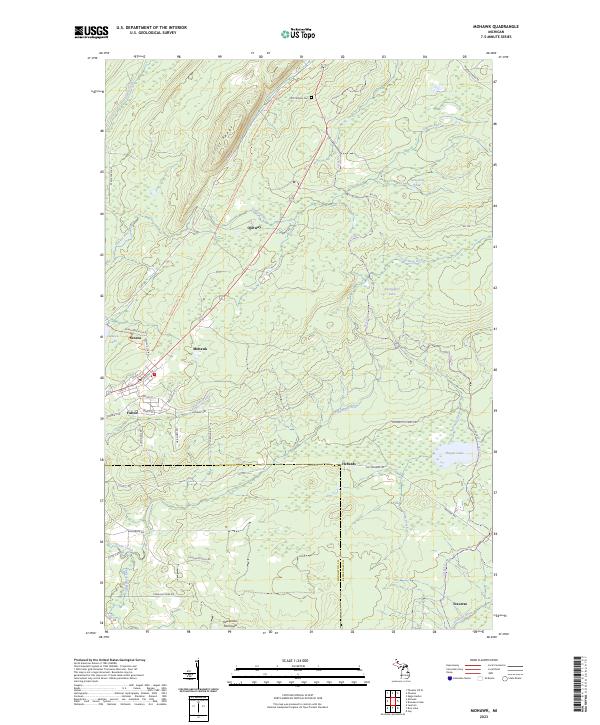
2023 Map of Mohawk
USGS Topo · Published 2023About this map
The Cliff Range forms a prominent natural spine through this portion of the northern Keweenaw Peninsula, framing a landscape defined by its mining heritage and rugged hydrology. Near the western edge, the settlements of Mohawk and Fulton sit clustered along a network of local streets like Union St and Cliff St, serving as the primary population centers. To the north, the smaller community of Ojibway lies along the Gratiot River, while Traverse sits at the southern reach near the Traverse River.
Find a feature on this map
54 named features on this map. Tap any name to fly to it.
Don’t see what you’re looking for? This feature index may not catch every label — zoom into the map to look around manually.
Map Details
Editions of this 2023 Mohawk Map
This is the sole edition of this map. No revisions or reprints were ever made.
Other maps of this area

1938 · Bruneau Creek
USGS Topo · 1:31,680

1938 · Gay
USGS Topo · 1:31,680

1940 · Central
USGS Topo · 1:31,680

1941 · Ahmeek
USGS Topo · 1:31,680

1941 · Mohawk
USGS Topo · 1:31,680

1946 · Phoenix
USGS Topo · 1:24,000

1946 · Bruneau Creek
USGS Topo · 1:24,000

1946 · Mohawk
USGS Topo · 1:24,000

1946 · Eagle Harbor
USGS Topo · 1:24,000

1946 · Ahmeek
USGS Topo · 1:24,000