1978 Map of Mohawk
USGS Topo · Published 1978About this map
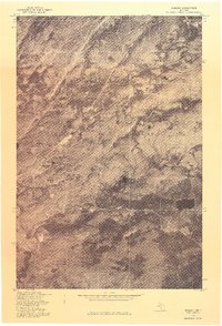
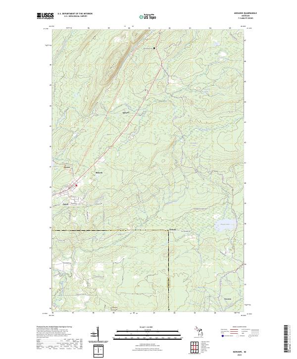
The copper mining landscape of Michigan’s Keweenaw Peninsula is captured in this orthophotograph, providing an overhead view of the industrial and residential patterns in late-1970s Keweenaw County. The image centers on the proximity of Mohawk and Fulton, two communities historically tied to the region's mineral wealth. Unlike a traditional topographic map, this aerial survey reveals the actual ground cover, forestation, and remnant clearings of the mining era. The alignment of roads and property lines, rectified from 1946 land data, cuts through the northern woodlands, showing the development of these small settlements. Researchers can study the density of structures and the surrounding wilderness as they appeared before modern changes, documenting the enduring footprint of these historic mining towns.
Find a feature on this map
2 named features on this map. Tap any name to fly to it.
Don’t see what you’re looking for? This feature index may not catch every label — zoom into the map to look around manually.
Map Details
Editions of this 1978 Mohawk Map
This is the sole edition of this map. No revisions or reprints were ever made.
Historical Maps of Houghton Township Through Time
9 maps found

Featured Locations
- Schoolcraft Township, MI
- Calumet Township, MI
- Houghton Township, MI
- Allouez Township, MI
- Seneca, Allouez Township