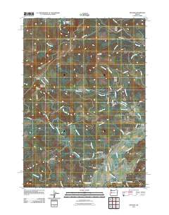
2011 Map of Mohawk
USGS Topo · Published 2011About this map
The Mohawk River valley defines this landscape in Lane County, where the settlement of Mohawk sits along the southern reaches of the waterway. The terrain is characterized by the prominent Coburg Hills and several isolated peaks including Buck Mountain, Round Mountain, and Tom Mount. This 2011 survey documents the dense network of forest service roads and timber access routes, such as Road 15-1-31 and Road 16-2-10 Rd, that crisscross the steep drainage basins of Whiskey Creek and Parsons Creek. For those researching local heritage, the map identifies the Mohawk Community Church Cemetery near the river and the Marcola Cemetery to the northeast. The geography transitions from the flat river valley into high ridges, with notable landmarks like Hayworth Saddle and Warner Lake marking the upland elevations.
Find a feature on this map
59 named features on this map. Tap any name to fly to it.
Don’t see what you’re looking for? This feature index may not catch every label — zoom into the map to look around manually.
Map Details
Editions of this 2011 Mohawk Map
This is the sole edition of this map. No revisions or reprints were ever made.
Other maps of this area
1909 · Rowland
USGS Topo · 1:31,680
1910 · Eugene
USGS Topo · 1:62,500
1912 · Halsey
USGS Topo · 1:62,500
1921 · Brownsville
USGS Topo · 1:62,500
1940 · Eugene
USGS Topo · 1:62,500
1941 · Halsey
USGS Topo · 1:62,500
1946 · Eugene
USGS Topo · 1:62,500
1949 · Eugene
USGS Topo · 1:62,500
1950 · Marcola
USGS Topo · 1:62,500
1950 · Brownsville
USGS Topo · 1:62,500