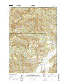
2014 Map of Mohawk
USGS Topo · Published 2014About this map
The Mohawk Valley landscape in Lane County is defined by the convergence of several drainages as they descend from the high ground of the Coburg Hills. At the heart of this rural area, the settlement of Mohawk sits along the Mohawk River, served by a network of local thoroughfares like Marcola Rd and Donna Rd. The terrain is characterized by prominent peaks including Buck Mtn, Round Mtn, and Tom Mt, which overlook the complex system of creeks feeding the valley floor.
Find a feature on this map
37 named features on this map. Tap any name to fly to it.
Don’t see what you’re looking for? This feature index may not catch every label — zoom into the map to look around manually.
Map Details
Editions of this 2014 Mohawk Map
This is the sole edition of this map. No revisions or reprints were ever made.
Other maps of this area

1909 · Rowland
USGS Topo · 1:31,680

1910 · Eugene
USGS Topo · 1:62,500

1912 · Halsey
USGS Topo · 1:62,500

1921 · Brownsville
USGS Topo · 1:62,500

1940 · Eugene
USGS Topo · 1:62,500

1941 · Halsey
USGS Topo · 1:62,500

1946 · Eugene
USGS Topo · 1:62,500

1949 · Eugene
USGS Topo · 1:62,500

1950 · Marcola
USGS Topo · 1:62,500

1950 · Brownsville
USGS Topo · 1:62,500