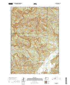
2020 Map of Mohawk
USGS Topo · Published 2020About this map
The Mohawk Valley serves as the central corridor for this part of Lane County, where the Mohawk River flows past the small community of Mohawk. The landscape is defined by the significant rise of the Coburg Hills to the west and several prominent peaks including Mt Tom, Buck Mtn, and Round Mtn. A network of logging and rural roads, such as Marcola Rd and McGowen Creek Rd, provides access to the high ridges and deep drainages of Parsons Cr and McGowan Cr.
Find a feature on this map
65 named features on this map. Tap any name to fly to it.
Don’t see what you’re looking for? This feature index may not catch every label — zoom into the map to look around manually.
Map Details
Editions of this 2020 Mohawk Map
This is the sole edition of this map. No revisions or reprints were ever made.
Other maps of this area

1909 · Rowland
USGS Topo · 1:31,680

1910 · Eugene
USGS Topo · 1:62,500

1912 · Halsey
USGS Topo · 1:62,500

1921 · Brownsville
USGS Topo · 1:62,500

1940 · Eugene
USGS Topo · 1:62,500

1941 · Halsey
USGS Topo · 1:62,500

1946 · Eugene
USGS Topo · 1:62,500

1949 · Eugene
USGS Topo · 1:62,500

1950 · Marcola
USGS Topo · 1:62,500

1950 · Brownsville
USGS Topo · 1:62,500