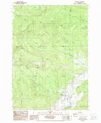
1988 Map of Mohawk
USGS Topo · Published 1988About this map
The Mohawk Valley dominates the southeastern portion of this terrain, where the Mohawk River winds through agricultural and developed lands just before the close of the 1980s. Rising sharply to the west, the Coburg Hills and Coburg Ridge define a dramatic vertical landscape marked by several prominent peaks, including Mt Tom, Buck Mountain, and Round Mountain. This area illustrates the intersection of natural resources and recreation, with multiple labeled quarries and a Rifle Range situated near the valley floor.
Find a feature on this map
23 named features on this map. Tap any name to fly to it.
Don’t see what you’re looking for? This feature index may not catch every label — zoom into the map to look around manually.
Map Details
Editions of this 1988 Mohawk Map
This is the sole edition of this map. No revisions or reprints were ever made.
Other maps of this area

1909 · Rowland
USGS Topo · 1:31,680

1910 · Eugene
USGS Topo · 1:62,500

1912 · Halsey
USGS Topo · 1:62,500

1921 · Brownsville
USGS Topo · 1:62,500

1940 · Eugene
USGS Topo · 1:62,500

1941 · Halsey
USGS Topo · 1:62,500

1946 · Eugene
USGS Topo · 1:62,500

1949 · Eugene
USGS Topo · 1:62,500

1950 · Marcola
USGS Topo · 1:62,500

1950 · Brownsville
USGS Topo · 1:62,500