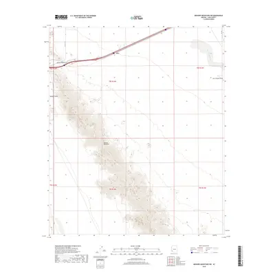
2018 Map of Mohawk Mountains NW
USGS Topo · Published 2018About this map
Mohawk Mountains dominate the southwestern portion of this Yuma County landscape, creating a stark vertical contrast against the broad desert basins that define the region's geography. Interstate 8 traverses the northern edge of the range, passing through Mohawk Pass near the small settlement of Kim. This corridor serves as a vital transportation artery, following a path between the Mohawk Valley to the west and the expansive San Cristobal Valley to the east. The drainage patterns are clearly marked by ephemeral features such as San Cristobal Wash and Owl Wash, which illustrate the hydrological movement across the arid terrain. The map's detail provides a look at the township and range survey lines that grid this corner of the Sonoran Desert, reflecting the systematic organization of land in the American West.
Find a feature on this map
15 named features on this map. Tap any name to fly to it.
Don’t see what you’re looking for? This feature index may not catch every label — zoom into the map to look around manually.
Map Details
Editions of this 2018 Mohawk Mountains NW Map
This is the sole edition of this map. No revisions or reprints were ever made.
Other maps of this area

1926 · Mohawk
USGS Topo · 1:62,500

1927 · Kim
USGS Topo · 1:62,500

1928 · Mohawk
USGS Topo · 1:62,500

1928 · Norton
USGS Topo · 1:62,500

1929 · Norton
USGS Topo · 1:62,500

1930 · Stoval
USGS Topo · 1:62,500

1931 · Kim
USGS Topo · 1:62,500

1950 · Stoval
USGS Topo · 1:62,500

1953 · Ajo
USGS Topo · 1:250,000

1955 · Growler
USGS Topo · 1:24,000