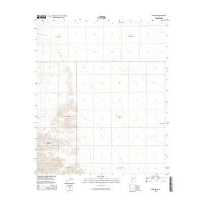
2014 Map of Mohawk SW
USGS Topo · Published 2014About this map
The arid landscape of the Arizona desert dominates this topographic survey of Yuma County. The most prominent geographic feature is the Mohawk Valley, which stretches across the central and eastern portions of the map. This broad expanse of low-lying terrain is flanked by the sharp elevations of the Copper Mountains to the west. The map provides a detailed view of the regional topography, illustrating the transition from the steep, craggy peaks of the mountain range to the wide, flat floor of the valley. This area is largely defined by its natural landforms rather than human development, showing the complex network of dry washes and desert terrain that characterizes the region south of the Mohawk Mountains.
Find a feature on this map
3 named features on this map. Tap any name to fly to it.
Don’t see what you’re looking for? This feature index may not catch every label — zoom into the map to look around manually.
Map Details
Editions of this 2014 Mohawk SW Map
This is the sole edition of this map. No revisions or reprints were ever made.
Other maps of this area

1926 · Wellton
USGS Topo · 1:62,500

1926 · Mohawk
USGS Topo · 1:62,500

1928 · Mohawk
USGS Topo · 1:62,500

1929 · Wellton
USGS Topo · 1:62,500

1942 · Yuma
USGS Topo · 1:250,000

1953 · Ajo
USGS Topo · 1:250,000

1954 · El Centro
USGS Topo · 1:250,000

1955 · El Centro
USGS Topo · 1:250,000

1957 · Ajo
USGS Topo · 1:250,000

1958 · Ajo
USGS Topo · 1:250,000