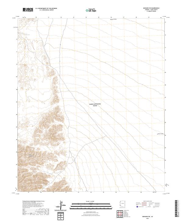
2021 Map of Mohawk SW
USGS Topo · Published 2021About this map
The Copper Mountains dominate the southwestern portion of this landscape, rising sharply from the surrounding desert floor. This area of Yuma County is defined by the stark transition between these high peaks and the broad expanse of the Mohawk Valley that stretches across the northern and eastern reaches. The map details a remote desert environment where the land is primarily organized by the Public Land Survey System, showing township and range lines such as t10s r17w and t11s r16w. The lack of named settlements or modern infrastructure underscores the character of this region as an arid wilderness, where natural landforms like the mountain ridges and valley basins dictate the sparse human footprint.
Find a feature on this map
8 named features on this map. Tap any name to fly to it.
Don’t see what you’re looking for? This feature index may not catch every label — zoom into the map to look around manually.
Map Details
Editions of this 2021 Mohawk SW Map
This is the sole edition of this map. No revisions or reprints were ever made.
Other maps of this area

1926 · Wellton
USGS Topo · 1:62,500

1926 · Mohawk
USGS Topo · 1:62,500

1928 · Mohawk
USGS Topo · 1:62,500

1929 · Wellton
USGS Topo · 1:62,500

1942 · Yuma
USGS Topo · 1:250,000

1953 · Ajo
USGS Topo · 1:250,000

1954 · El Centro
USGS Topo · 1:250,000

1955 · El Centro
USGS Topo · 1:250,000

1957 · Ajo
USGS Topo · 1:250,000

1958 · Ajo
USGS Topo · 1:250,000